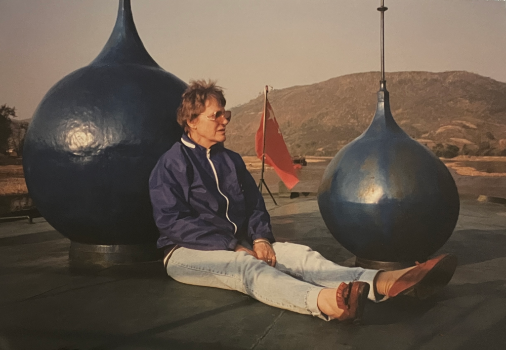
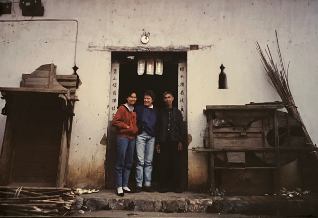
Mum had come to stay for a couple of weeks with me in Hong Kong. Guilin’s reputation was a must-visit destination for expats living in the region, so I booked us a trip to Guilin to explore its splendour. Guilin and the region formerly opened for tourism in 1973 however it wasn’t until the late 1980s that the former industrial manufacturing factories and infrastructure was removed allowing tourism infrastructure and cultural mindset and know how to truely begin. When we visited in December 1996 Guilin, Yangshuo, the Li River and Longji terraced rice fields were a travellers’ heaven! There was enough tourism infrastructure and experience to be able to travel and see its amazing beauty and be hosted by welcoming local communities, whilst not so many tourists and over-build that the magic was ruined.
Mum had not travelled internationally much and not for a couple of decades. The Guilin trip was fantastic for her as it was exotic, stunning, inviting, comfortable (enough anyway) and not dangerous.
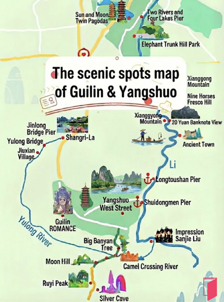
Guilin is a prefecture-level city in the northeast of China’s Guangxi Zhuang Autonomous Region. It is situated on the west bank of the Li River and borders Hunan to the north. Within the Guilin prefecture is included Guilin city, the area along the Li River down to and including Xingping and Yuangshuo to the south, and the Longji rice terrace fields to the north of Guilin city.
In December, the Guilin prefecture weather is reasonably cold with an average temperature range of 3 – 14 degrees and whilst not as much rain it can still be misty.
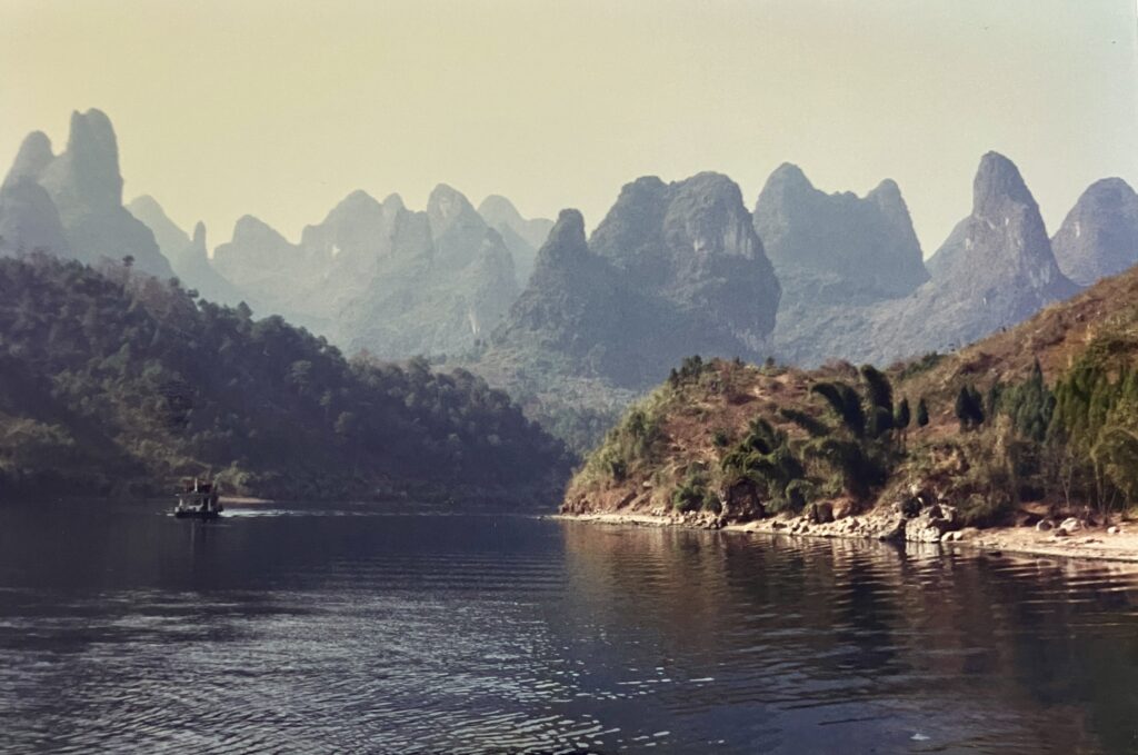
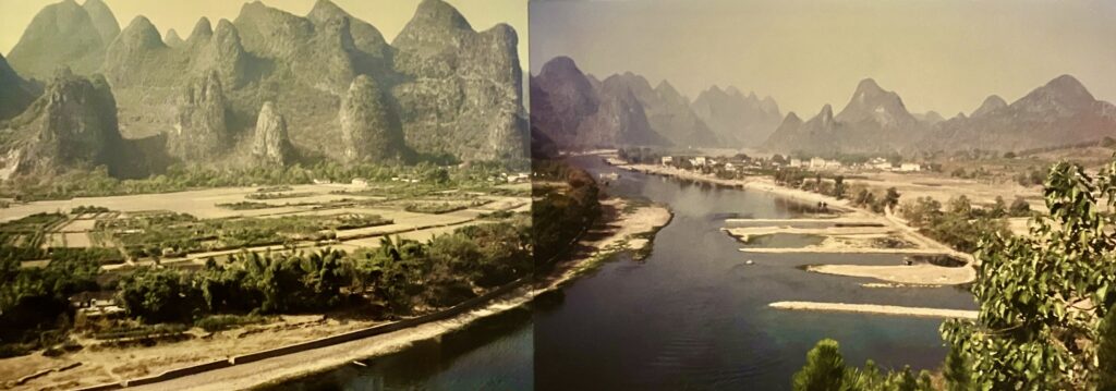
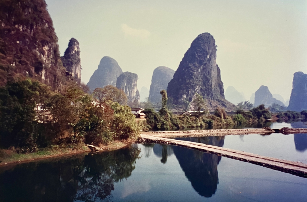
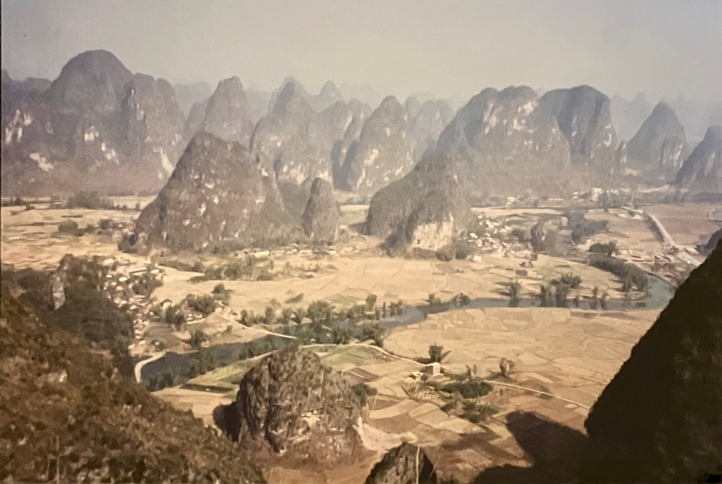
Guilin’s landscape is globally famous for its “cone” (fengcong) and “tower” (fenglin) karst formations. Shaped by tectonic uplift, humid subtropical climate, and thick limestone deposits, these formations represent the quintessential “Guilin model” of karst evolution. The tower karst are isolated, steep-sided limestone peaks which rise abruptly from flat alluvial plains, such as Elephant Trunk Hill in Guilin city or Moon Hill in Yangshuo. The cone karst are clustered, cone-shaped hills that share a continuous bedrock base, separated by deep, bowl-shaped depressions, such as Putao Section (Yangshuo County) and Lijiang National Park (Lijiang Section). For the scientists curious for more about the Guilin karst, click here.
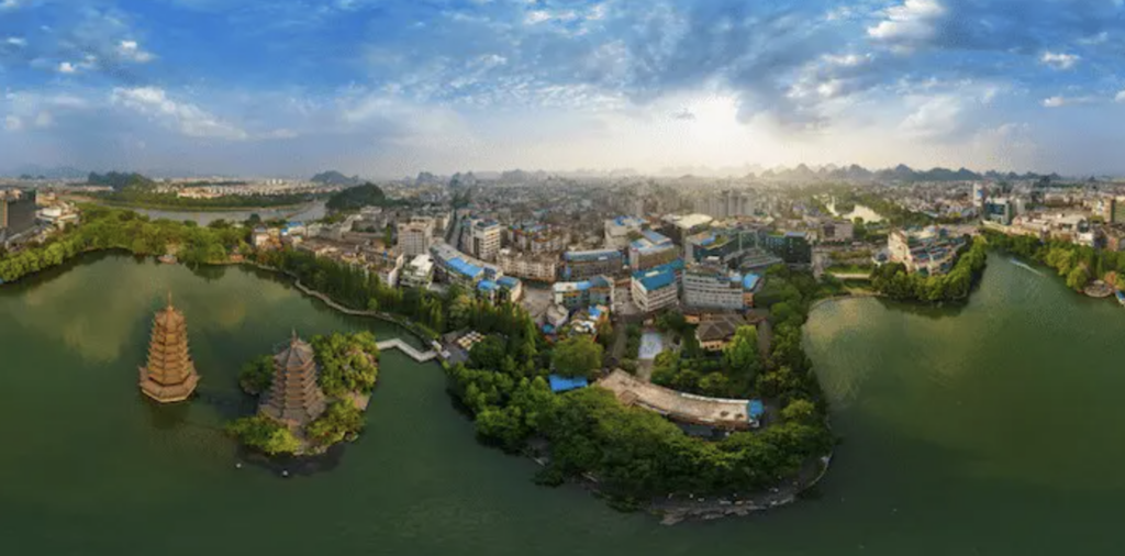
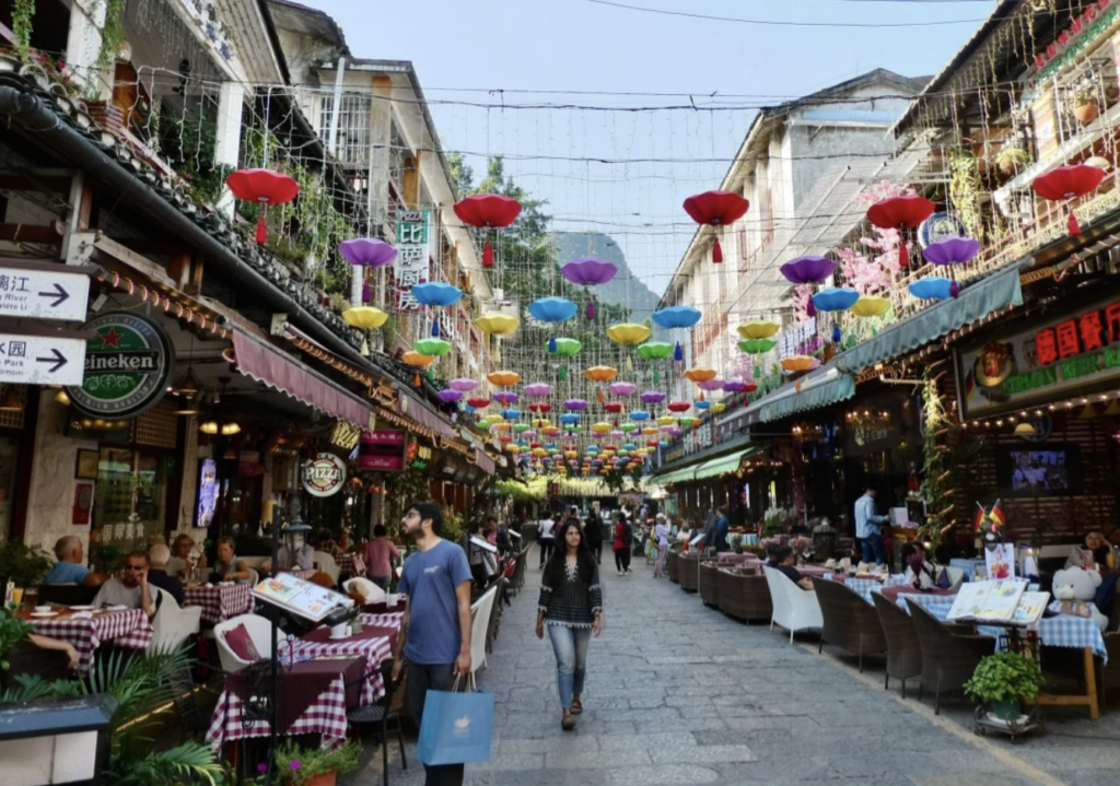
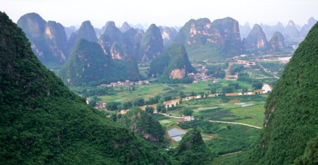
In 1996, the Guilin prefecture had roughly 1.2 million people in total with Guilin city being much larger than Yangshuo. In 2020, the Guilin prefecture has nearly 5 million people, which is an increase of 420% in 25 years. This shows the massive influx into the region due to its success as one of China’s premier tourism attractions. Looking between photos I took on the trip with Mum and more recent photos it is evident the increase in buildings, infrastructure and tourist numbers.
Today, the broader Guilin region is home to 12 different ethnicities, though predominantly Han Chinese at 85% and Zhuang people represent only 5% today. In 1996, Han Chinese made up 62% and the Zhuang minority comprising 31%. This is a marked change over 30 years and significantly impacts culture and traditions within the region’s communities. Also in 1996, the vast majority of the region’s workforce were still primarily engaged in agriculture. Today, the primary industry of workforce engagement is tourism and hospitality. During the mid 1990s, Guilin’s natural landscape resources were beginning to be strategically evaluated, setting the foundation for extensive 1998–2008 environmental rehabilitation and tourism infrastructure development.
The history of social policy for the region is starkly different to the feeling of welcoming tourism. I have covered this history and the traumatic events which occurred in a separate post entitled “The Guilin paradox: harsh societal history amidst a beautiful backdrop“.
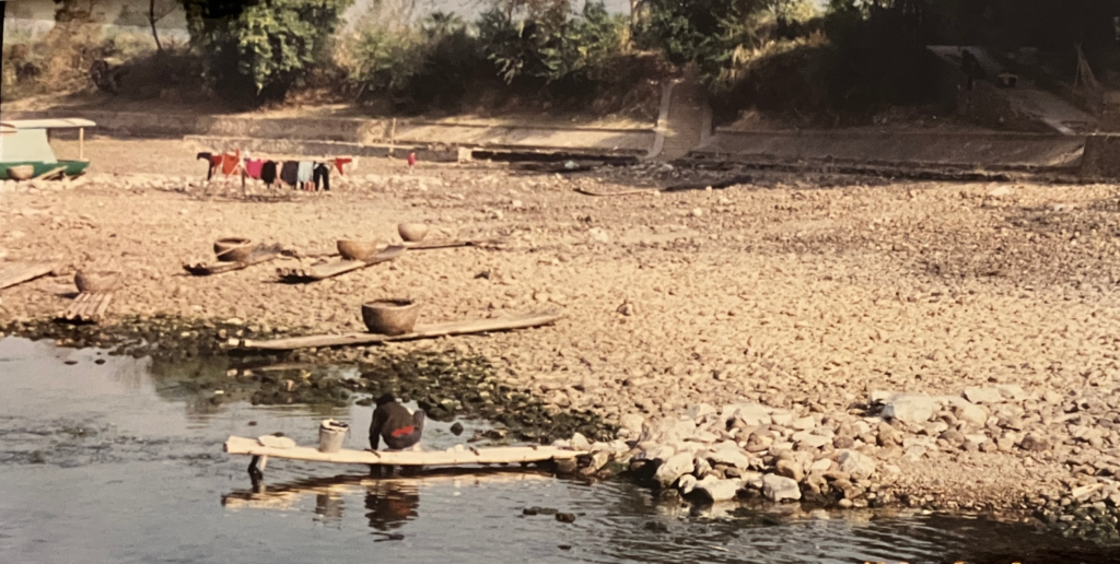
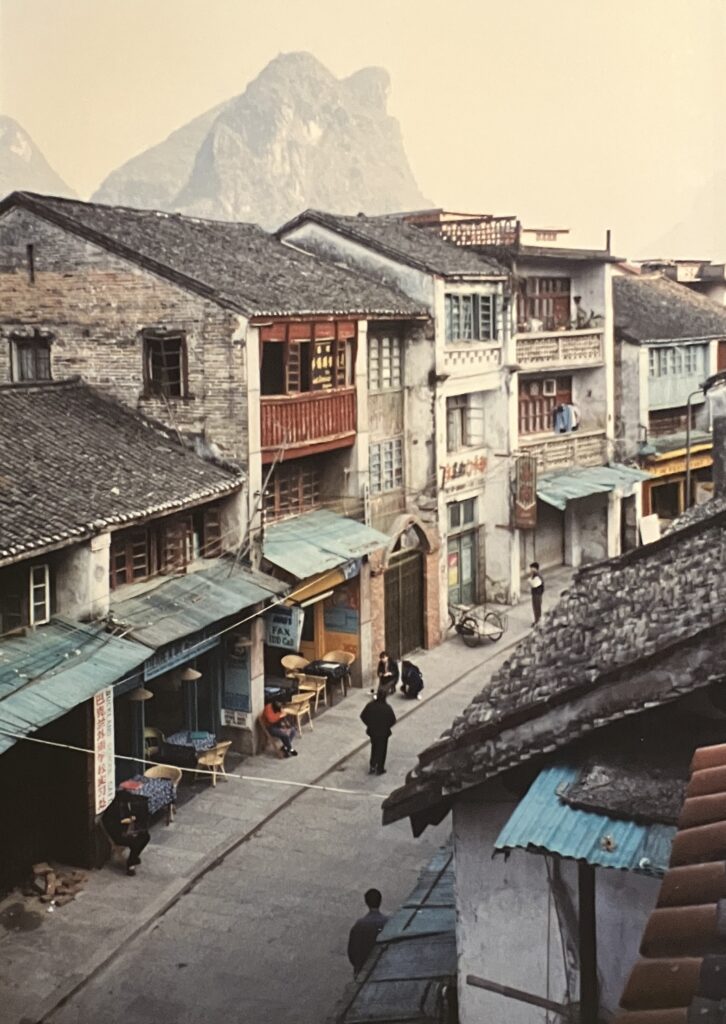
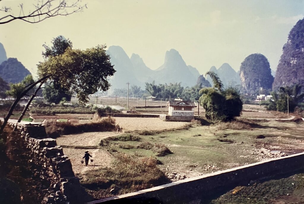
In writing this segment for the trip Mum and I made to Guilin area in 1996 and looking at what information and photos are available online I have a strong sense of the true nature of the region being missed by most tourists. Key tourism elements are now set up for the perfect photo or city-like perfect food experience rather than true immersion and experiencing local life and nature. In 1996, agriculture and rural life was still dominant with tourism only in its fledgling stages of life. This comes through in the photos in include here, Yangshuo and Longji rice terraces.
Guilin city is the entry point for exploring the area. We explored the city and found Elephant Trunk Hill fantastic. It is the official symbol of Guilin. This unique rock formation arches over the Li River, resembling an elephant dipping its trunk into the water. According to local folklore, a celestial elephant belonging to the Heavenly Emperor came down to earth to help Guilin’s villagers plow their fields and carry water. When the Emperor demanded the elephant return to heaven, it refused, choosing to stay and help the mortal people. A fierce battle ensued. While the elephant was drinking from the river to quench its thirst, the Emperor stabbed it in the back with a magic sword, turning it to stone. Today, the “sword hilt” is visible as the Puxian Pagoda resting on the elephant’s back.
Other attractions include the Reed Flute Cave, however I couldn’t bring us to visit it. I don’t agree with the heavy addition of coloured lights and music to beautiful caves on the premise the cave is not stunning enough without the additions.
In the time since 1996, the new infrastructure developed includes the Two Rivers and Four Lakes which is a scenic network of interconnected waterways in the city. A night cruise offers dazzling views of illuminated pagodas, bridges, and pavilions. This also includes the twin Sun and Moon Pagodas (one bronze, one glass), located in Fir Lake.
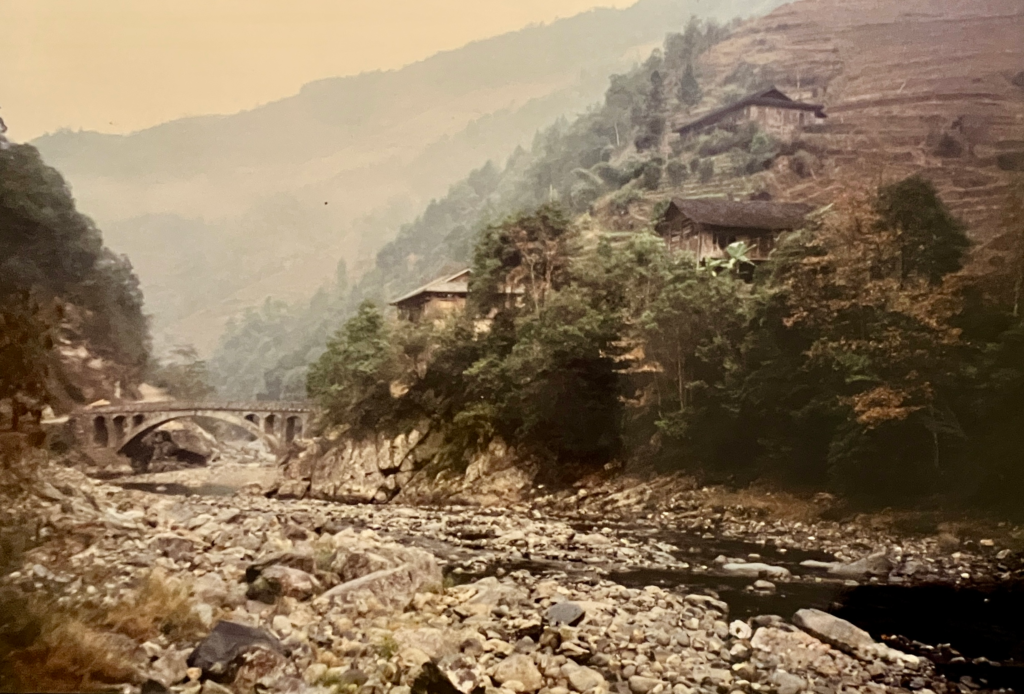
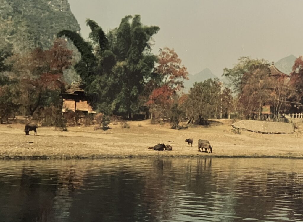
Whilst the Li River boat ride from Guilin to Yangshuo can be done in one day covering 83 kms in 4 hours, it is much better broken into two with an overnight stay in Xingping. The boat is easy to book and catch from Guilin and you can roam the boat around as you meander along the Li River. It was fantastic watching daily rural life in action!
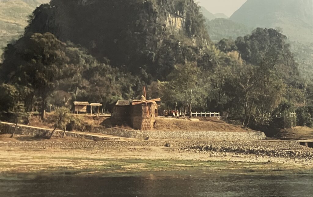
Xingping is one of the crown jewels of the Li River in Yangshuo area. It is a 1,700 year old ancient town which developed through the Ming and Qing dynasties. The Ming dynasty (1368–1644) was ruled by ethnic Han Chinese, while the Qing dynasty (1644–1912) was founded and ruled by the Manchu people from the north. It has been preserved as small and well-preserved with traditional architecture, cobble-stone streets now courting local coffee shops, craft stores, and authentic eateries (a great place to try local Yangshuo specialties like beer fish).
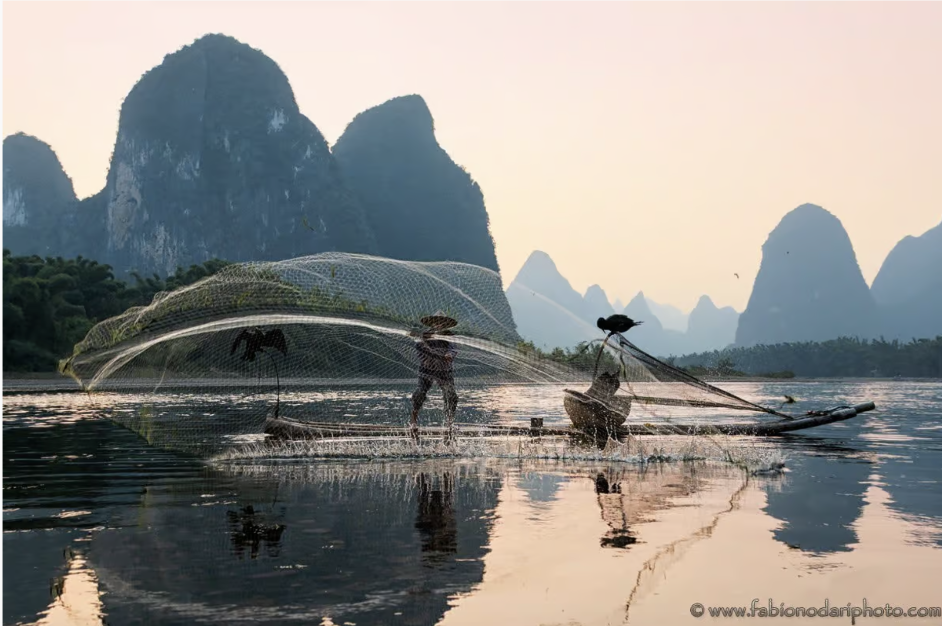
Many of the key attractions along the Li River are clustered around Xingping, including the old town (where you will stay overnight), Laozhai Mountain (later afternoon / sunset), local fishing village with fisherman and cormorants (best with a clear sunset), Xianggong Mountain (sunrise / early morning), the Chinese 20 RMB yuan note photo, and Nine Horses Painting Mountain. The Nine Horses myth says that nine divine horses descended from the heavens to admire the beauty of the Li River. They refused to leave and were turned into the limestone mountains lining the water.
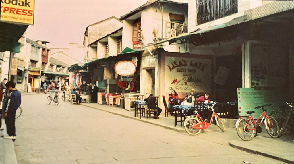
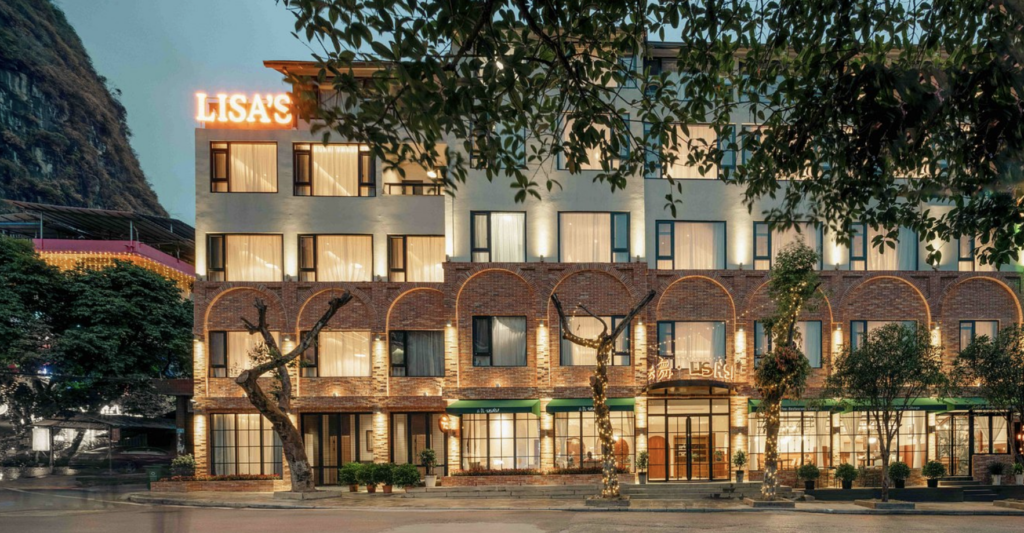
Whilst the boat journeys’ were a highlight, Yangshuo was my favourite stop off. It has a magic vibe and being able to cycle around the area was a lot of fun. We stayed at Lisa’s cafe and Hostel, on West Street back in 1996 (see in photo below). It had originally opened late 1985 and has since grown and changed location within Yangshuo, now known as Yangshuo Lisa Boutique Hotel today (compare the difference with the more recent photo below). Lisa’s is recognised as one of the pioneers that transformed a sleepy fishing village into an international backpacker hub. Over 1,400 years old, West Street is considered the heart of Yangshuo township.
To help us understand the culture, history and immersion we hired a guide for the day who was a young women who lived with her family and had grown up on the edge of the Yangshuo village. Cycling around she took us to many areas plus we had lunch with her parents in their home.
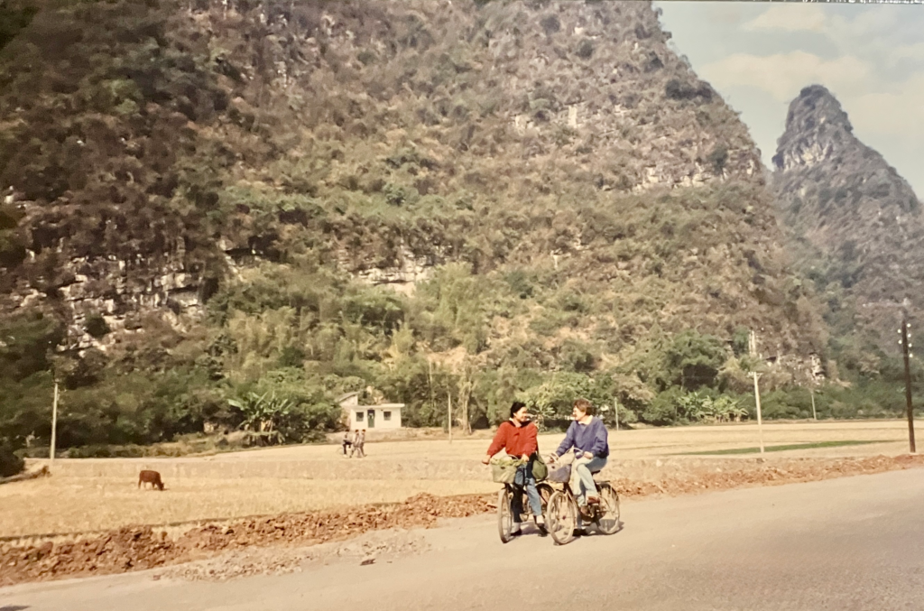
Mum hadn’t cycled in over 10 years which was funny to watch as she wobbled around until she got used to it again. Towards the final stage of the days’ riding we were heading up a slight hill and there were quiet a few locals walking or cycling around us. Mum got distracted and fell off, going a very slow pace, but a nearby passing gentleman thought it was his fault! It was lovely to see his genuine concern and care to make sure Mum was okay, whilst we were reassuring him he was not at fault and thanking him for his help.
Moon Hill is 8kms south of Yangshuo and provides a sensational view over the Yulong River valley, local rural villages, and a sweeping sea of surrounding karst peaks. It is a 230-meter karst limestone hill with a massive natural arch near the top. The famous arch in the mountain gets its name because the sunlight creates varying “moon phase” effects (from crescent to full moon) depending on the angle you view it from. It is a half hour 800 steps hike to the arch where you have great 360 degree panorama views.
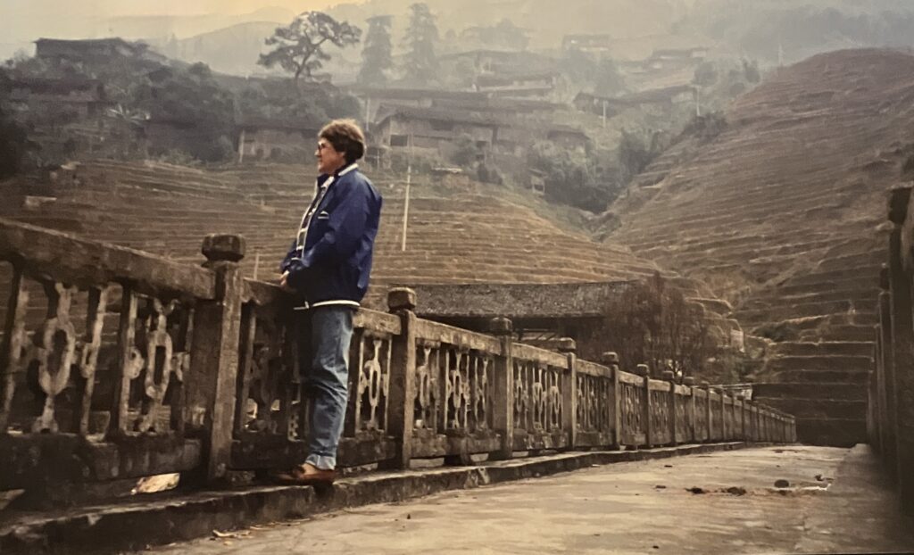
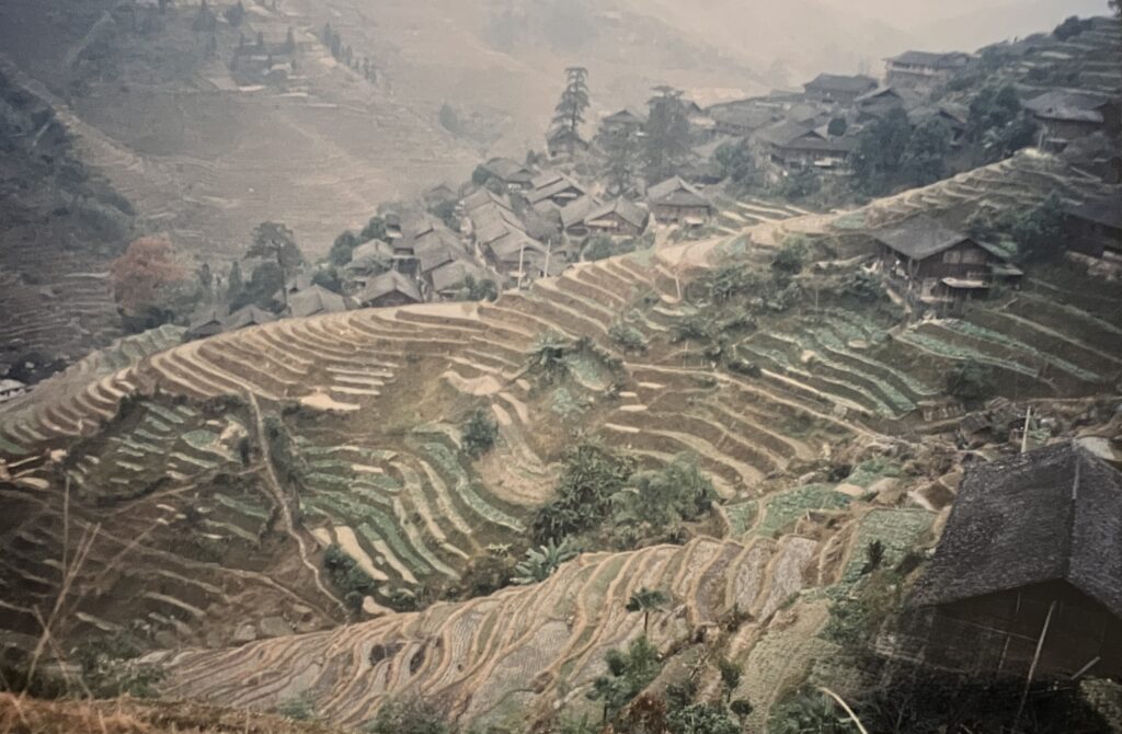
On our final day before flying our of Guilin back to Hong Kong, we had caught the boat back and then a car to the Longji (translating to Dragon’s Backbone) terraced rice fields roughly 80kms north of Guilin. They are 650 year old of agricultural heritage, spanning elevations of up to 1,100 meters. Construction began during the Yuan Dynasty (1271–1368) and was perfected over 600 years by ingenious local Zhuang and Yao farmers who developed sustainable irrigation directly from mountain springs. The landscape winds along mountainsides to resemble a dragon’s scales.