Guilin’s landscape is globally famous for its “cone” (fengcong) and “tower” (fenglin) karst formations. Shaped by highly soluble carbonate rock (mostly Devonian limestone and dolomite), tectonic uplift, humid subtropical climate, and abundant water for erosion these formations represent the quintessential “Guilin model” of karst evolution.
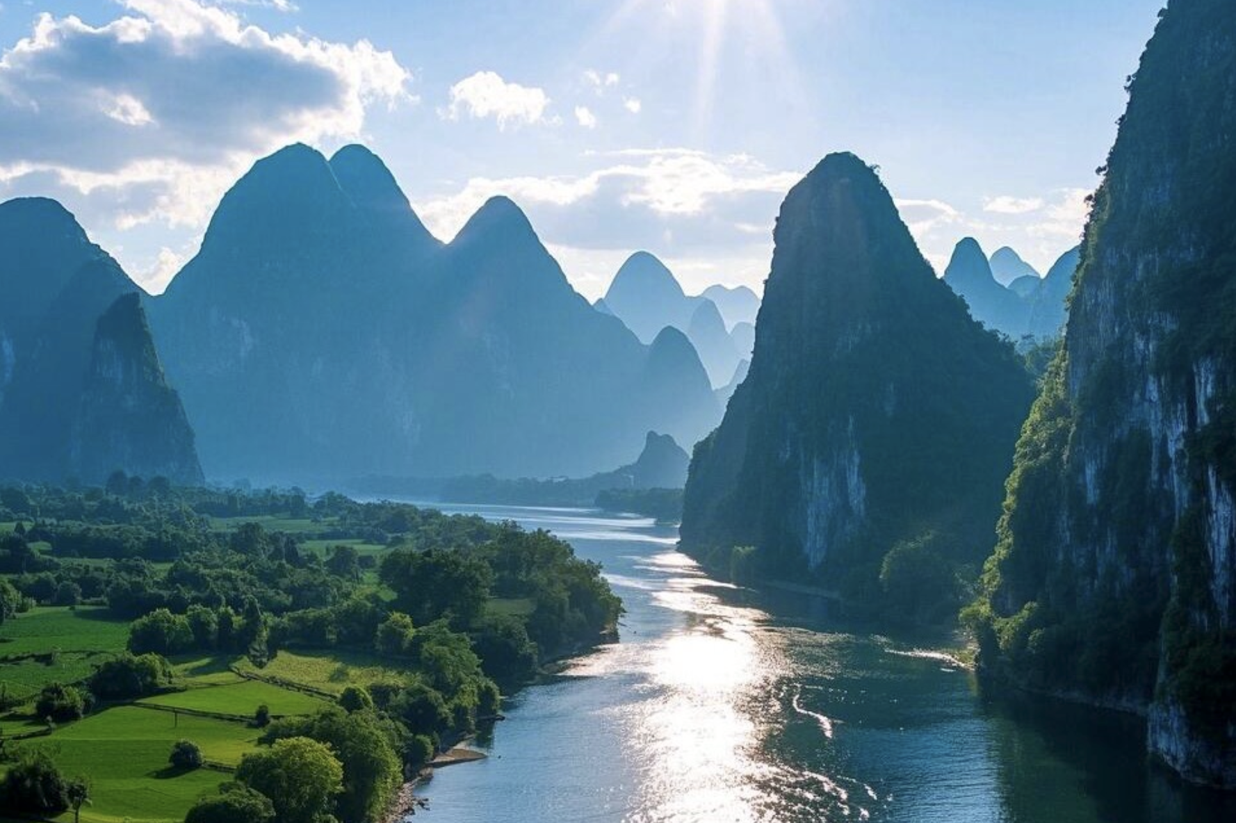
The tower karst are isolated, steep-sided limestone peaks which rise abruptly from flat alluvial plains, such as Elephant Trunk Hill in Guilin city or Moon Hill in Yangshuo. The main photo above is an example of tower karst formations along the Li River. The cone karst are clustered, cone-shaped hills that share a continuous bedrock base, separated by deep, bowl-shaped depressions, such as Putao Section (Yangshuo County) and Lijiang National Park (Lijiang Section).
Within the Guilin region, cone karst and tower karst evolved in a synergetic co-existence system, as shown in the geo-profile below.
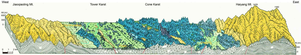
The geological architecture and evolution of the area encompass a few key features, as follows:
Bedrock & tectonic folding
- Carbonate successions: the bedrock in the Guilin area consists of a remarkably thick (up to 3,000 meters) sequence of limestone and dolomite dating back to the Paleozoic era (primarily Upper Devonian to Lower Carboniferous periods).
- Anticlines and Synclines: shaped by ancient Paleozoic tectonic movements, these thick carbonate deposits were folded into distinct, undulating structures known as anticlines (upward folds) and synclines (downward folds). This structural folding created a natural basin setting highly conducive to water channeling and karst development.
Uplift and erosion
- Tectonic uplift: the collision of the Indian and Eurasian tectonic plates (which built the Himalayas) generated significant regional uplift across Southwest China. This tectonic lifting raised the ancient, once-submerged limestone seabed above the regional water table, exposing the rock to the elements.
- Weathering: over the last 40 million years, Guilin’s warm, humid, monsoon-heavy climate provided ideal conditions for rain and flowing water to weather and dissolve the exposed rock.
Surface landforms
The dissolution of the limestone has created spectacular variations of karst terrain:
- Tower karst (Fenglin or Peak Forest): characterized by isolated, sheer, needle-like towers or pinnacles rising dramatically from flat, alluvial plains (like the iconic peaks along the Li River). These form primarily in lower terrains where lateral river erosion dominates.
- Cone karst (Fengcong or Peak Cluster): characterized by connected, cone-shaped mountain bases that share a common foundation. These are typically found in slightly elevated areas where the water table is deep, allowing precipitation to cause vertical erosion.
Extensive underground networks
The extensive dissolution of the bedrock didn’t just sculpt the mountains above; it created an intricate, massive underground plumbing system.
- Caves & sinkholes: slightly acidic rain and groundwater seeped through surface fractures, widening them over millions of years. This resulted in large-scale bedrock dissolution, carving enormous underground cave networks.
- Stalactites and underground rivers: famous subterranean systems in the region—such as the Reed Flute Cave and Seven-Star Cave—feature complex stalactites, stalagmites, and subterranean pools carved by underground rivers that connect to surface waterways like the Li River.